In early 1837, William Coghill was overlanding to Port Phillip District to take up land. He had an arrangement with John Hepburn, and they met at the Murrumbidgee River where the sheep were depastured. About this time, they met up with William Bowman, who was overlanding 5,000 sheep to Port Phillip District, intending to establish a station in the Macedon area. The three parties then travelled together.
William Bowman was well acquainted with the Coghill brothers, as they had land near his own. The 1828 Census lists William and his two children, Helen (Ellen) and George, residing in the Wingecarribee district [30]. William Bowman had once owned an inn on the Wingecarribee River.
William Coghill arrived in Sydney on the convict ship Mangles commanded by his brother, Captain John Coghill, on Wed, 27 Oct 1824[28]. Christine Wright, in her 2001 article on John Coghill, records: “In 1822, before settling in New South Wales, John Coghill had obtained a grant of land at Wingecarribee, near Berrima. On the 1824 Mangles voyage, he brought out his brother, William, and two of William’s children to work on that property; the rest of William’s family arrived in 1829″[29]. No citation is made to provide evidence for this assertion. Wright had access to the Coghill mss in the Mitchell Library, so it is conjectured that there is evidence of William’s occupation of his brother’s property in 1824. The two children were the oldest daughter, Helen (b. 1812) and George (b. 1816), who were aged 11 and 7 years old respectively when they arrived in Sydney.
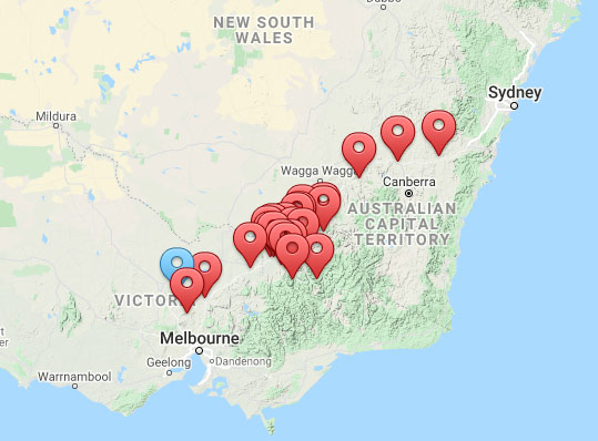
In November 1825, William was promised 600 acres of land by Governor Thomas Brisbane. He subsequently occupied a portion of land immediately west of Mittagong. The property was subsequently called “Currockbilly”. “Currockbilly” is located at GPS -34.425944, 150.398412 (at 100 Wombeyan Caves Road), it is shown on the Parish of Berrima map, 3rd ed. 1889 as Par. No. 315, 600 acres with owner William Coghill, immediately east of Par. 357 “Woodlands”, 1000 acres owned by Thomas McVitte (sic). Currockbilly is now on the Wombeyan Caves Road; however, in 1834, shortly after the line of the then, New Great Southern Road was laid out, it would have been immediately to the northwest of the point where the road turns to the southwest, some 5km from Mittagong.
William and his family subsequently occupied Currockbilly and built a wooden dwelling in which he resided. This is mentioned in George Bell’s account of his trip to rural New South Wales, February-March 1834 in which he records a visit to William Coghill to the west of Mittagong[33] Bell overnighted on 3 March at Cutter’s Inn[34][35][36] which was located on the east side of the current Mittagong, he continues his narrative thus:
- “On the 4th I arose soon after sunrise & took my road thro’ the bush in a fine sharp morning, being the coldest I have felt in this country. In about 1½ miles I came upon the new line of road [presumed to be Surveyor-General Thomas Mitchell’s new Great South road, the plan of which was presented to Governor Ralph Darling in early 1830] which I pursued for about 3 miles thro’ forest until I found a cart track leading to the right which I followed thro’ the bush & saw some beautiful blue & red Parrots. Passing through a beautiful piece of low open forest land I came to Wm Coghill’s whose dogs frightened me when going to the house which was a common wooden one. Here I found the master laid up & unable to move from rheumatism & the whole house in confusion from their having been obliged to raise the flooring to destroy a snake which had got in beneath. After having bfast & a chat with poor WC I took my leave. Returning to the main road I went on to Berrima where I met with Tasker who was kind & I dined with him in his slab hut. He then made me got on horseback, shewed me the site of the intended stone bridge over the river Uinjeecaribee [ie Wingecarribee] [ed note: at the current Berrima] which we forded & proceeded thro’ the bush to the farm of Jn Atkinson …” [John Atkinson had a property of 2000 acres in the Parish of Bong Bong immediately south of the township of Berrima].
Details of William’s promise of land from Governor Thomas Brisbane in 1825 and subsequent Deeds of Grant in 1838 are recorded in the NSW Government Gazette: “WILLIAM COGHILL, 600, Six hundred acres, parish unnamed, at Currockbilly; bounded on the west by a line south 75 chains, commencing at the north-east corner of J. M’Vitie’s (sic) 1,000 acres grant; on the south by a line east 80 chains; on the east by a line north 75 chains; and on the north by a line west 80 chains to the north-east corner of J. M’Vitie’s (sic) grant aforesaid. Promised by Sir Thomas Brisbane, November 12, 1825. Quit-rent £5 sterling per annum, commencing 1st January, 1833.”[37]. The Grant of Land Deed was dated 13 Dec 1838 “237. William Coghill, 600 acres, Camden”[38].
In January 1837, David Coghil, then 23 years old, applied for a parcel of land 320 acres immediately north-west of Currockbilly (and north of the adjoining property Woodlands subsequently granted to M’Vitte)[46]. There is no record of it being granted to him. This may have occasioned his joining the journey of Hepburn and his father from the Braidwood area to the Loddon.
Information about William Coghill’s overland journey with Hepburn and others is found in some reminiscences in the Argus, May 1905[47]. It notes that Hepburn “took up” Smeaton Hill on 15 April 1838, and William and David Coghill their properties Glendaruell and Glendonald, respectively, “ten days after”. David would have been 23 years old. William (the son) would have been 16 years old, whether it was he or his father who took up Glendaruell is unknown. ~~Neil McKellar Stewart 2/11/20~~
- Featured image; Flock of Sheep by the River, 1870s Charles Francois Daubigny